Ireland Completes Historic 16-Year Airborne Geophysics Survey
Ireland has completed a 16-year airborne geophysics survey after 440,000km of flying, making it one of the best geologically mapped countries in the world.

Ireland has joined a select group of countries to have fully mapped its geology from the air, as the Tellus Programme completes its final flight after 16 years and more than 440,000 kilometres of surveying.
The programme, managed by Geological Survey Ireland, a division of the Department of Climate, Energy and the Environment, took off in 2011 in the border region with European Interreg cross-border funding before becoming a national survey under the National Development Plan.
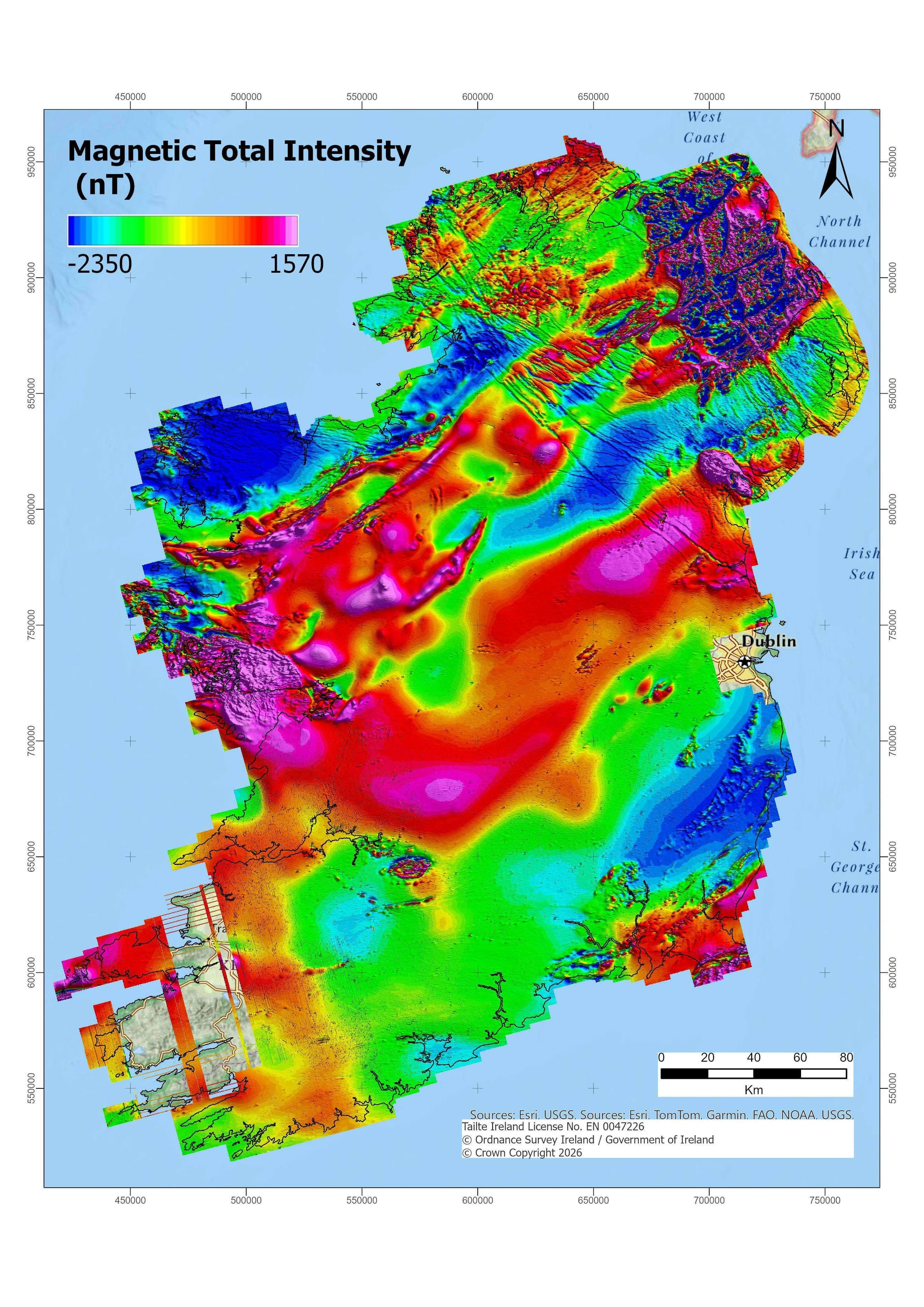
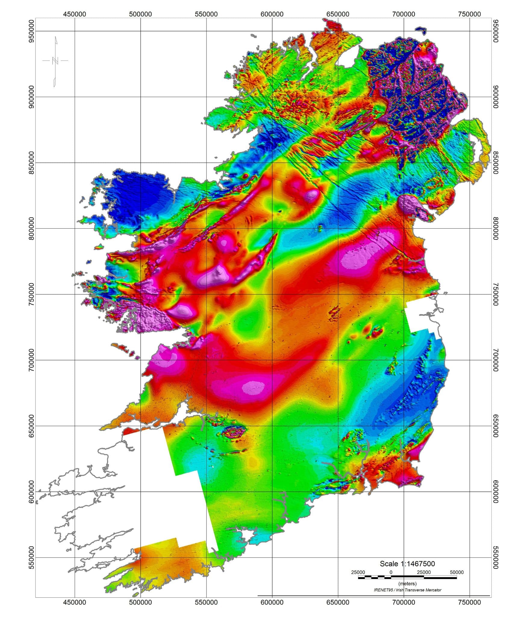
Named after Tellus, the Roman goddess of the earth, the airborne survey was operated by specialist Canadian company Sander Geophysics Ltd. It collects magnetic, electromagnetic and natural radioactivity data from the rocks and soils beneath Ireland's surface, supporting natural resource management, environmental monitoring, the identification of radon risk areas, and geological mapping.
Koen Verbruggen, Director, Geological Survey Ireland:
"After 16 years, I am delighted to see the final survey flight and completion of the Tellus airborne geophysics survey. More hard work follows in investigating, modelling and mapping the data. However, this is a hugely significant moment for Ireland as we will have better scientific data to help make decisions on how we best manage our natural resources. We will be making this data freely available, and I look forward to seeing it support policy, industry and research in a variety of areas. Finally, I would like to thank all who have been involved in this fantastic project."
Data has been processed and is currently available to download for around 80% of the country, with the final dataset due to be merged with all other survey data and made available in 2027. All maps and data are free to download from Geological Survey Ireland's website.
The survey aircraft flew at a low altitude of just 60 metres, requiring extensive coordination with landowners and stakeholders. The delicate instruments on board cannot operate in rain, wind or cloud, meaning considerable patience was required from all involved over the course of the project.
Geological Survey Ireland expressed thanks to the entire team, landowners and stakeholders for their cooperation across the 16 years, and paid tribute to the skill and dedication of the pilots, who have likely seen more of Ireland from the air than anyone else.
The completion of the survey places Ireland among the best geologically mapped countries in the world and a leader in geophysical survey data in Europe.