Cork Basks in Settled Spell as Sunny Skies Dominate the Week Ahead
Met Éireann forecasts a dry, increasingly sunny week for Cork, with highest temperatures reaching the mid-twenties by midweek.
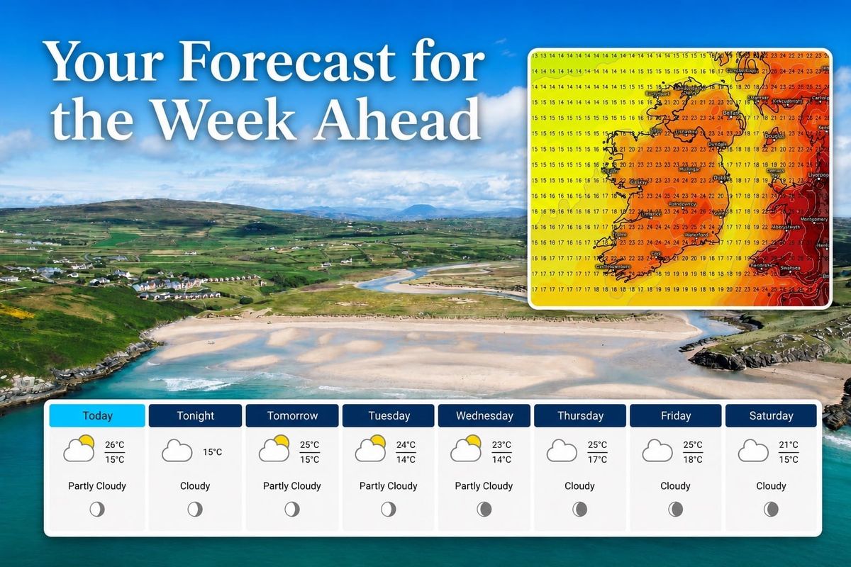
Met Éireann is forecasting a largely dry week for Cork, with hazy sunny spells becoming more widespread and temperatures climbing into the mid-twenties by midweek, according to the forecast issued at 05:45 on Sunday 5 July.
Today, Sunday 5 July, a few spots of drizzle are possible this morning, but conditions will otherwise stay dry. Hazy sunny spells are expected to develop in many areas, although cloud may persist in some northern and western parts. Highest temperatures will reach 16 to 24 degrees, warmest in the southeast and coolest near western coasts, with light to moderate west to southwest winds. Analysis of the latest ECMWF and GFS weather model charts supports this outlook, pointing to winds generally below 20 km/h with gusts staying under 30 km/h, and pressure rising through the evening towards 1,020 hPa, with both models in close agreement.
Tonight will be mostly cloudy and dry, with lowest temperatures of 11 to 14 degrees and light to moderate west to southwest winds. Met Éireann has also issued a high pollen forecast for both Sunday and Monday, along with a high or moderate solar UV index across the same period.
Tomorrow, Monday 6 July, will be dry, and after a mostly cloudy start, hazy sunny spells will develop in most areas. Highest temperatures of 19 to 24 degrees are forecast generally, a little cooler near western coasts, with light to moderate westerly winds. Monday night will be mostly cloudy with a few spots of light rain, drizzle and patchy mist in the west and north, staying mainly dry with variable cloud and clear spells elsewhere. Lowest temperatures will fall to 11 to 14 degrees. Model chart analysis agrees on a dry, settled day, with widely spaced isobars, gusts staying below 30 km/h, and high confidence in continued dry conditions.
Tuesday will start mostly cloudy, with patchy drizzle in the north and west. Sunny spells developing first in the southeast are expected to extend further north and west as the day goes on. Highest temperatures of 18 to 25 degrees are forecast, warmest in the east and southeast. Tuesday night will bring cloud and a few spots of drizzle in the west and northwest, staying dry with clear spells elsewhere, with patches of mist and fog forming overnight. Chart analysis corroborates this picture, adding that winds may gust to 35 km/h near exposed coasts and that pressure is expected to hold around 1,021 hPa, with model confidence rated moderate to high.
By Wednesday, morning mist and fog will clear, leaving a mostly dry day, although a few spots of drizzle remain possible in the west and northwest. Sunny spells developing first in the southeast are expected to become more widespread through the day, with highest temperatures of 18 to 25 degrees, warmest in Leinster and Munster. Wednesday night will stay dry with clear spells for most at first, although cloud will increase from the west overnight. This aligns closely with the model chart analysis, which also points to morning mist and fog clearing quickly, light winds allowing sea breezes to develop near the coast, and high confidence in the continued dry, settled pattern.
Thursday will begin mostly cloudy, with scattered outbreaks of rain across parts of Munster, Connacht and Ulster. This rain is expected to become confined to northern and western areas later in the day as warm and sunny spells develop elsewhere. Highest temperatures will range between 17 or 18 degrees in the northwest and 25 degrees in the south and southeast. Chart analysis corroborates the general pattern of rain clearing to sunny spells, noting that showers moving through are expected to be light, mainly affecting western Munster, with a chance they could reach Cork City briefly before clearing. Confidence on the exact timing is rated only moderate, as the ECMWF model clears the rain band more quickly than the GFS model, which keeps showers lingering longer into the day.
Friday 10 July falls outside Met Éireann's current issued forecast. Based on weather chart analysis alone, high pressure is expected to build back in, bringing a return to dry conditions with sunny spells and highest temperatures of 20 to 24 degrees. As this is model guidance rather than an official Met Éireann forecast, it should be treated as indicative only and will be updated once Met Éireann's own bulletin extends to cover that day.