Weather Outlook for the Week Ahead
Unsettled week for Cork with heaviest rain Tuesday bringing flooding risk. Showers mid-week, further rain Friday.
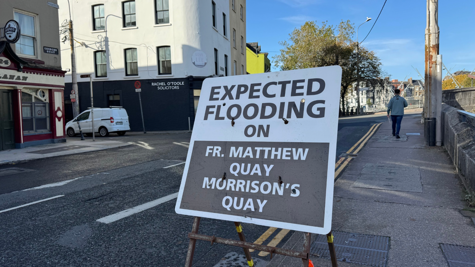
Met Éireann has issued a Status Yellow rain warning for Cork, effective from midnight to midday on Tuesday, 11 November, with persistent heavy rain bringing localised flooding, difficult travel conditions, and poor visibility across the county.
The warning, issued at 11:00 on Sunday, covers Cork, Kerry, and Waterford as unsettled weather continues through the week ahead. Tuesday will mark the wettest day of an already rainy period, with conditions remaining unsettled into Friday.
Sunday Night into Monday
Cloudy and wet conditions will continue tonight with outbreaks of rain becoming widespread before pushing away to the north later. Near calm conditions will allow mist to thicken to fog in some parts towards dawn. Lowest temperatures will range from 3 to 7 degrees.
Monday will offer a brief respite. Any mist and fog will clear in the morning to leave a bright day with sunny spells and scattered showers. Highest temperatures of 9 to 12 degrees in light southerly winds.
However, Monday night will see conditions deteriorate rapidly. Cloud and outbreaks of rain and drizzle will gradually spread northeastwards across Cork, with some of the rain heavy and spot flooding possible. Light to moderate southeast winds will increase fresh to strong and gusty as the rain develops. Lowest temperatures will range from 6 to 9 degrees.
Tuesday: Status Yellow Warning Period
Tuesday will be a wet and blustery day. Rain will be heavy at times with localised flooding expected, particularly during the morning hours covered by the warning period. Mist and hill and coastal fog will further reduce visibility.
Highest temperatures of 12 to 15 degrees in moderate to fresh, occasionally strong, and gusty southeast winds veering southerly through the day.
Further spells of rain or showers will continue on Tuesday night, heavy at times, but a clearance to drier weather with clear spells and just isolated showers will develop overnight. Lowest temperatures of 7 to 11 degrees with southerly winds generally easing. Mist and fog patches will develop.
Wednesday Through Friday
Wednesday will see any mist and fog clear in the morning to leave variable cloud and a few bright or sunny spells. Further spells of rain could affect parts of the south and east, with drier conditions and just the odd shower further north and west. Highest temperatures of 11 to 14 degrees in light variable breezes becoming easterly later.
Thursday will see further showers or longer spells of rain. Highest temperatures of 9 to 14 degrees in a freshening northeasterly wind.
Friday will continue unsettled with low pressure pushing up further spells of rain or showers across the county.
Looking Ahead
There are early indications of potentially cooler and more settled conditions extending from the north through next weekend.
Met Éireann advises the public to expect localised flooding, difficult travel conditions, and poor visibility during the Status Yellow warning period on Tuesday. Motorists should allow extra time for journeys and exercise caution on the roads.