
Warm And Humid Thursday For Cork As Fresher Air Moves In Tonight
The CSA HQ weather station did not drop below 19.9 degrees overnight. Met Éireann forecasts a warm, humid Thursday before fresher air and a mainly dry weekend.

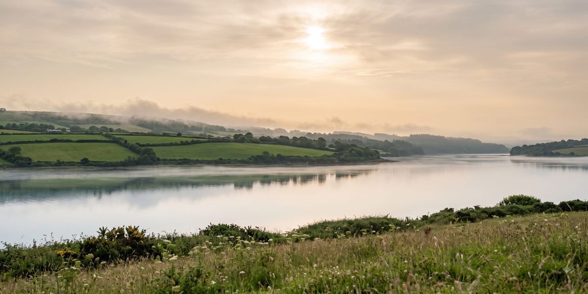
Cork faces another warm and humid day on 13 August 2026 after a night in which temperatures barely moved, with our own weather station holding within a degree and a half of 20 from midnight right through to just before 8am. Met Éireann is forecasting highest temperatures that will generally range from 23 to 28 degrees nationally, though coastal parts of the southwest will stay closer to 20 degrees.
Today: Humid, Warm And Largely Dry
The national forecaster describes today as humid and generally very warm, with variable cloud and sunny spells, the best of these further east. There will be a good lot of dry weather for much of the day, but with scattered showers too, especially further west, and the chance of the odd isolated thunderstorm. During the evening, showers or showery rain will generally start to move eastwards.
Winds will be light to moderate and mainly southwesterly. Met Éireann has also flagged some hill and coastal fog in the southwest and west, worth noting for anyone travelling on higher ground in west Cork.
Overnight At The CSA HQ Weather Station
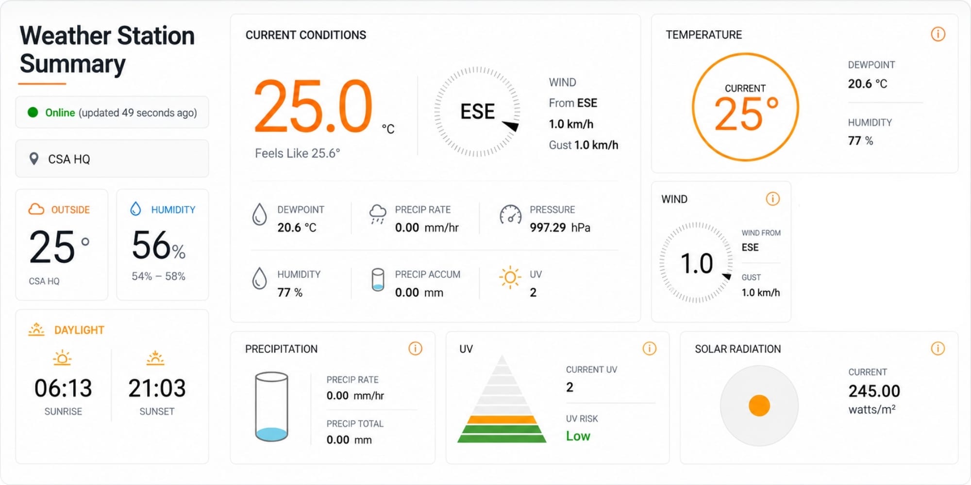
Data from our CSA HQ Weather Station gives a sense of just how muggy the night was. Between midnight and shortly before 8am, the temperature moved within a narrow band of 19.9 to 21.4 degrees, and never dropped below 19.9. Relative humidity sat at 99 per cent for the entire period, with dew points between 19.7 and 21.2 degrees.
Meteorologists generally use a minimum of 20 degrees as the threshold for what is known as a tropical night, an uncommon occurrence in Ireland. On those figures, our weather station came within a tenth of a degree of the mark. Air pressure over the same period ranged between 996.61 and 997.63 hPa, winds were almost entirely calm at under 2 km/h and mostly easterly, and no rainfall was recorded.
Forecasters Split On The 30 Degree Mark
Two independent forecasting pages have gone slightly further than Met Éireann's published range for today. Weather Alerts Ireland forecast temperatures reaching 30 degrees once again, describing another hot day in the east, with cooler conditions again in the west and northwest bringing some cloud cover and showers, and some thundery showers possible in the northwest later in the day. Carlow Weather also forecast up to 30 degrees, warmest in the east and southeast, with some heavy showers about and a risk of local thunderstorms mainly in the west and north, but possible in the midlands too.
What The Charts Show
Met Éireann's own temperature forecast map for 4pm is consistent with figures around the 30 degree mark in the greater Dublin area, while showing values of roughly 20 to 21 degrees along the Cork coast and the mid twenties a short distance inland. Model output from the Danish Meteorological Institute's HARMONIE run, also timed for 4pm, shows the same pattern, with the deepest heat over the midlands and southeast and cooler air hugging the south and west coasts.
Rainfall radar at 9.05am showed the most active showers over the west and northwest, along with a band of heavier returns running through the midlands. Cork was largely dry at that point, with only scattered light returns close to the south and southwest coast.
Tonight: Fresher Air Arrives
Tonight will be rather cloudy and humid for a time, with scattered showers or showery outbreaks of rain and the chance of a few thunderstorms. A clearance to fresher conditions will then extend from the Atlantic overnight, bringing clear spells and just a few isolated light showers. Lowest temperatures will fall to 13 to 16 degrees, a considerably fresher night than the one just gone, in light to moderate southwest winds veering west to northwest.
Friday 14 August
Friday will be a fresher day, with a fair deal of cloud around but some sunny spells too. There will be plenty of dry weather with just some well scattered showers, mainly further west. Highest temperatures will range from 18 degreesalong the west coast up to 23 or 24 degrees in the southeast, in light to moderate northwest breezes.
Friday night will be mainly dry with variable cloud and clear spells and just a few isolated showers in the west and north, with lows of 11 to 14 degrees.
The Weekend
The weekend outlook is a largely settled one.
Saturday 15 August will be mainly dry with variable cloud and sunny spells, and just a few isolated light showers, mainly in the north and west. Highest temperatures will range from around 16 or 17 degrees in the northwest to 22 degrees in the southeast, in a light to moderate west to northwest breeze. Saturday night looks likely to hold dry for many, though Met Éireann notes the chance that a little showery rain will spread from the west for a time.
Sunday 16 August is likely to bring a good deal of dry weather with a mix of cloud and some bright or sunny spells. Cloud is likely to increase through the day, with the chance of some rain and drizzle along the west coast later in the day. Highest temperatures of 17 to 22 degrees are expected in light variable breezes, becoming light to moderate southwesterly. For now, Met Éireann expects some scattered outbreaks of rain and drizzle to move in from the west on Sunday night, with lows of 13 to 17 degrees in freshening southerly winds.
Monday 17 August Onwards
The settled spell looks set to break at the start of next week, with Met Éireann expecting a more changeable Atlantic regime to take over from Monday.
Monday will be breezy and cloudy for a time, with rain spreading eastwards across the country through the morning and early afternoon, heavy at times. That rain will be followed by bright or sunny spells and a scattering of showers, with highest temperatures of 19 to 23 degrees in fresh and gusty southerly winds, strong at times in coastal parts of the west and south.
Tuesday 18 August will be cooler and fresher, with a mix of cloud, sunny spells and showers, and a longer spell of rain possible further to the north. Highest temperatures of 16 to 20 degrees are expected, with fresh and gusty westerly winds.
Wednesday 19 August currently looks set to bring a good deal of dry weather with bright or sunny spells and highs of 15 to 20 degrees.
Pollen And UV
Met Éireann rates the pollen forecast as moderate on Thursday and Friday, while the solar UV index is moderate to highacross both days.
Source: Met Éireann forecast issued 13 August 2026 at 5.30am, with supporting observations from the CSA HQ weather station and forecast commentary from Weather Alerts Ireland and Carlow Weather.