Storm Amy Meteorologists Commentary: Heavy Rain Today Followed by Very Strong Winds and Flooding Risk on Friday
West Cork mountains face significant flooding risk.
Cork is bracing for the first named storm of the season as Storm Amy prepares to deliver a double blow of severe weather. Heavy rainfall will sweep across the county today, Thursday 2nd October, followed by very strong south-westerly winds and more torrential rain throughout Friday.
The storm, named by the UK Met Office, poses a significant flooding risk to west Cork's mountainous areas, where up to 100mm of rainfall could fall within 48 hours. Met Éireann has issued both yellow and orange warnings for rainfall and wind, with potential impacts continuing into Saturday for parts of the north-west.
Storm Amy's development has been fuelled by the Atlantic's unsettled conditions following hurricanes Humberto, which dissipated on Wednesday, and Imelda, currently active near Bermuda. This turbulent weather is strengthening the jet stream and creating conditions for rapid intensification as the low-pressure system tracks towards Ireland.
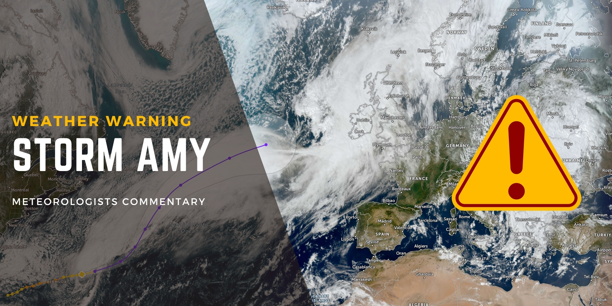
Figure 1 – A Low Pressure System, named Storm Amy, tracking towards Ireland
Ailís Hankinson, Met Éireann meteorologist, says:
"Storm Amy will bring wet and very windy conditions on Friday, and it's preceded by a band of heavy rain on Thursday. It is the first storm of the season so it's essential to be prepared for potential impacts caused by the strong winds and the rain. There could be difficult travelling conditions, loose objects or flying debris. Trees are still in leaf at this time of the year, so there could be higher impacts from fallen trees and leaves blocking drains, causing localised flooding."
West Cork residents should prepare for particularly challenging conditions. Mountainous areas in Kerry, west Cork and west Limerick face the highest flooding risk as persistent rain falls on already saturated ground. Small upland river catchments and urban areas are most vulnerable, with surface water flooding expected as fallen leaves block drains and waterways.
The storm will create dangerous travelling conditions across Cork's major routes, including the N40, N71 and N22. Motorists should expect debris on roads, potential power outages, and fallen trees. High-sided vehicles face particular risks on exposed sections, especially when crossing elevated areas like the N22 between Macroom and Cork city.
ESB Networks warns the public to stay away from fallen cables and report incidents immediately to 1800 372 999. Power restoration times can be monitored at powercheck.ie.
Coastal communities should exercise extreme caution. Despite neap tides, strong onshore winds and significant waves may cause spray overtopping at high tide along the west coast.
Met Éireann emphasises that warnings will be updated as new weather models are analysed. Wind warnings could extend into Saturday for north-western areas. Residents should monitor met.ie, the Met Éireann app, or their social media channels for the latest updates.
Storm Amy follows eight previous October storms that have affected Ireland since the naming initiative began in 2015. Last season's Storm Éowyn, which struck in January 2025, recorded a provisional record gust of 184km/h at Mace Head, County Galway, the strongest ever recorded in Ireland.
With trees still in full leaf, Cork faces higher risks than typical winter storms. Authorities urge residents to secure outdoor items, charge mobile phones, keep emergency supplies, and avoid travel unless necessary. Anyone driving should anticipate fallen trees, flooding, and dangerous conditions on exposed roads.
Small businesses along Cork's quays and low-lying areas should review flood preparation plans. The OPW's flood maps at floodinfo.ie show areas at historical risk. Remember: just 150mm of fast-flowing water can knock you off your feet, and 300mm can move most cars.
Cork County Council and Cork City Council continue to monitor the situation closely and will provide updates through official channels and Cork Safety Alerts. For the latest local impacts, check your local authority websites and emergency service social media.