M28 Cork to Ringaskiddy Project Launches Dedicated Website
Live camera feeds coming to M28.ie in early 2026 to track construction progress - website now live with 3D views and journey times.

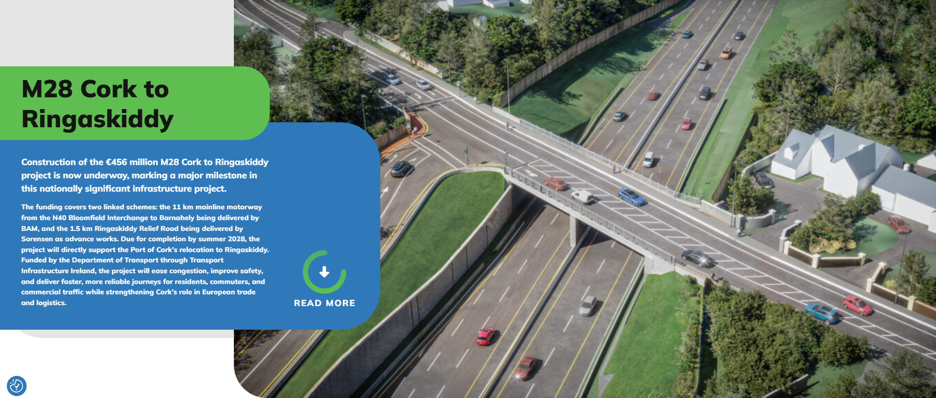
The €456 million M28 Cork to Ringaskiddy motorway project has launched a new website providing the public with comprehensive information about the scheme, including interactive 3D visualizations, live journey times, and details on archaeological and ecological work along the route.
The website, M28.ie, serves as the central information hub for the project throughout its construction phase. It offers regular updates on construction progress, upcoming works, and traffic management arrangements.
The €456 million project consists of two linked schemes: the 11 km mainline motorway from the N40 Bloomfield Interchange to Barnabely being delivered by BAM, and the 1.5 km Ringaskiddy Relief Road being delivered by Sorensen as advance works. The project is due for completion in summer 2028.
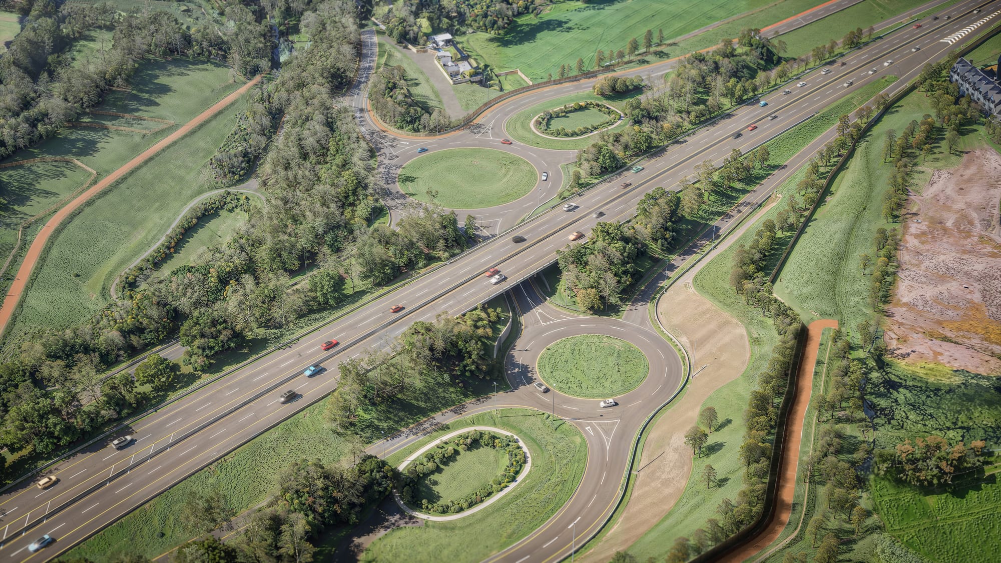
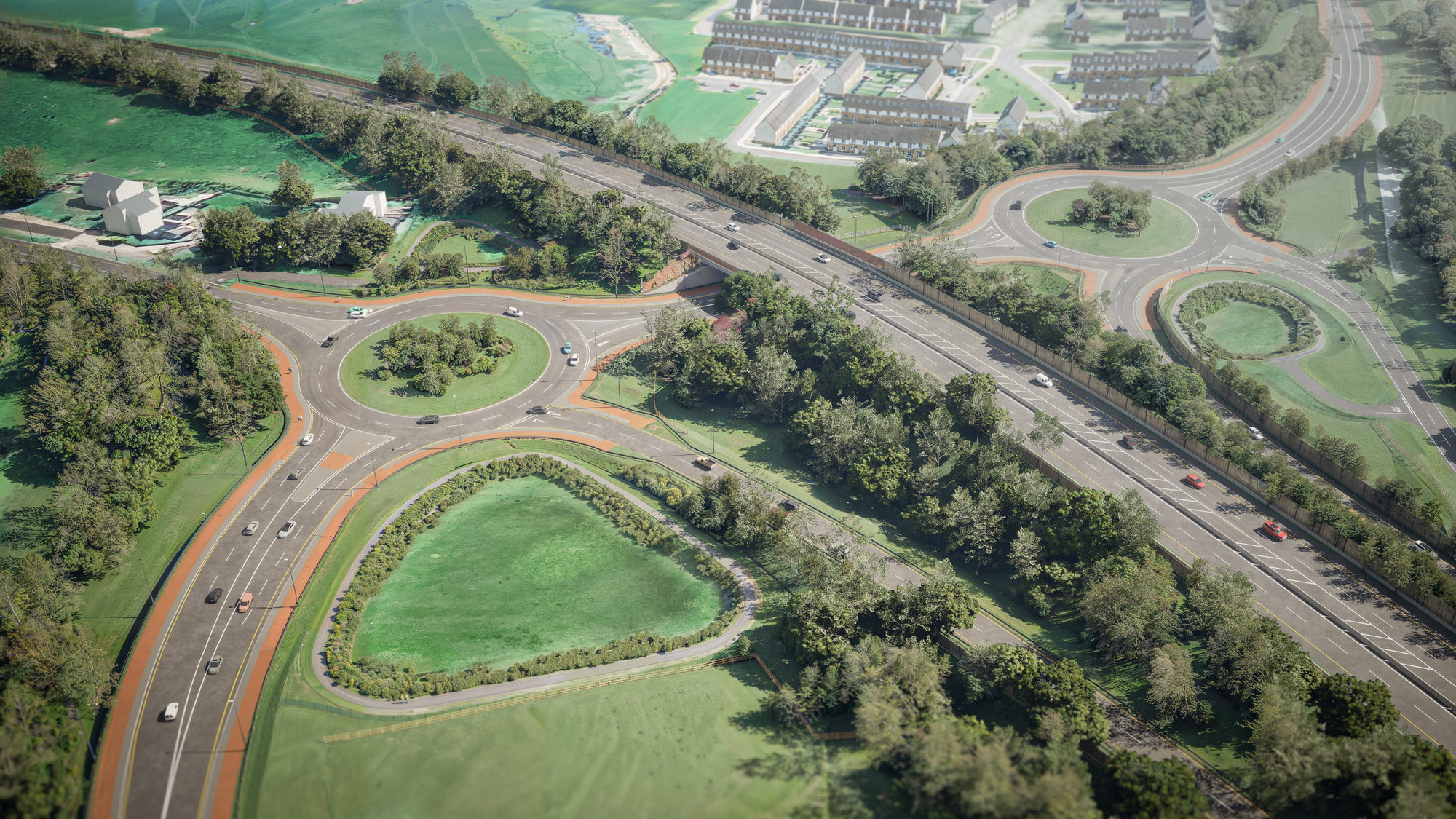
One of the website's key features is a series of interactive 3D visualizations showing key junctions and intersections along the route. Users can explore 360-degree views of locations including Rochestown, Maryborough, Carr's Hill, Shannonpark, and Shanbally, providing a clear picture of how the finished scheme will look and function.

The site also includes a live journey times feature, allowing users to view current travel times between key points on the route, including N28 Ringaskiddy, N28 Shannonpark, N40 Dunkettle Interchange, and N40 Kinsale Road Roundabout.
Dedicated sections on archaeology and ecology highlight the discoveries made during construction and the measures being implemented to protect local habitats and wildlife. The Environmental Impact Statement identified sensitive habitats and protected species along the route, leading to a detailed programme of ecological assessment, mitigation, and ongoing monitoring.
Specialist ecologists were appointed to survey habitats, monitor protected species, and design measures to maintain ecological connectivity during and after construction. Engineering design, drainage, earthworks, and landscaping have all been adapted to respond to the ecological needs of the corridor.

Archaeological investigations have also been undertaken, with Cork County Council appointing specialist consultants led by Rubicon Heritage Services Ltd working under the oversight of the National Monuments Service and Transport Infrastructure Ireland's Project Archaeologist.
The Department of Transport funded the project through Transport Infrastructure Ireland, with the aim of easing congestion, improving safety, and delivering faster, more reliable journeys for residents and commercial traffic while strengthening Cork's role in European trade and logistics.