Leeside Lanes: From Walking Nuns to Suburban Streets - The Hidden History of Nuns Walk
Gallows Green to Greenmount: How Cork transformed an execution site into schools and suburbs. The dark history beneath Ballyphehane's streets.
- A quiet residential street in Ballyphehane reveals centuries of Cork's transformation, from medieval religious paths to modern housing estates
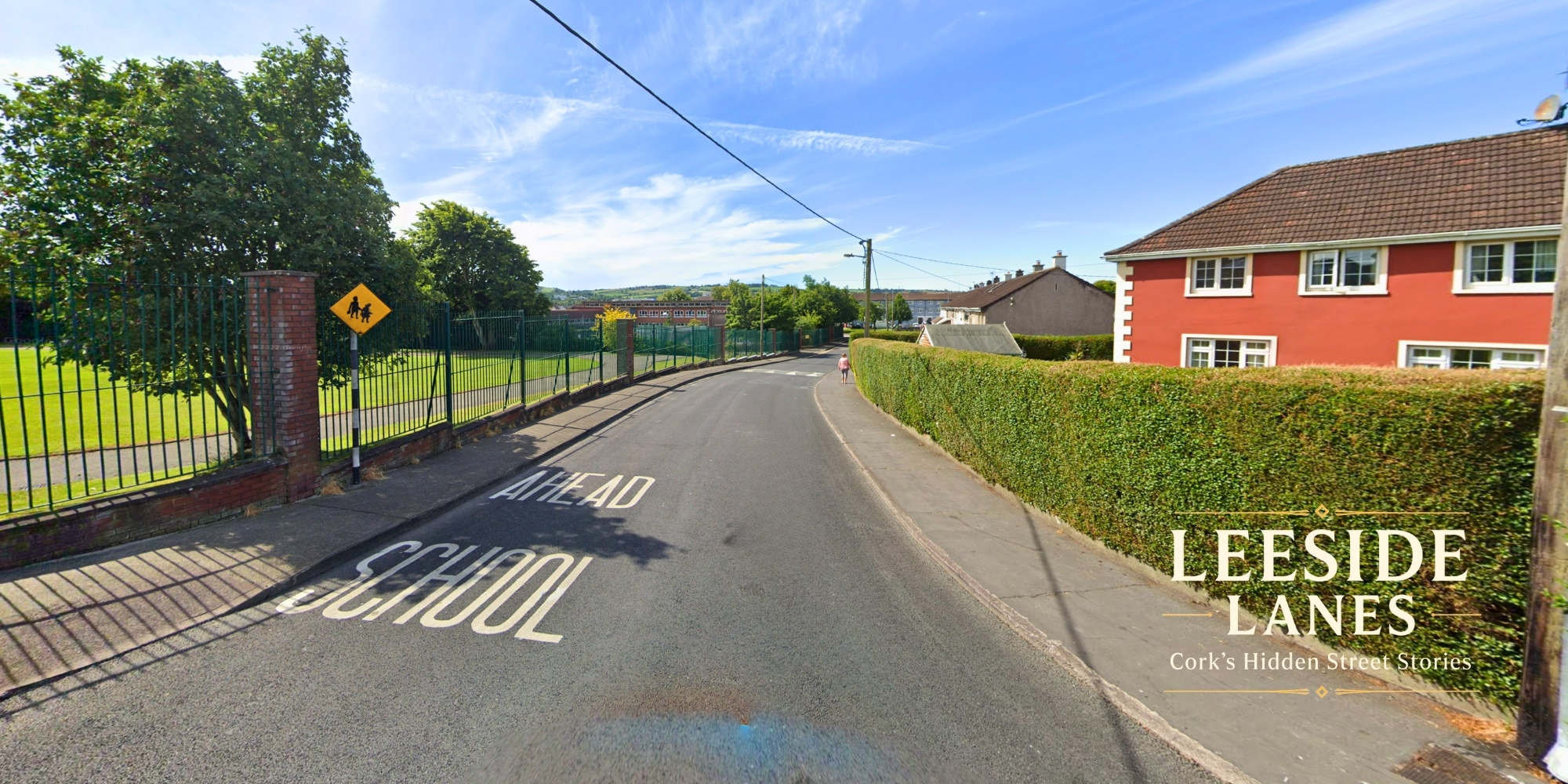
Tucked away in Cork's southern suburbs, Nuns Walk appears unremarkable at first glance: a short residential street of mid-20th century homes connecting Pouladuff Road to the wider Ballyphehane neighbourhood. Yet this modest cul-de-sac carries within its name and landscape over 500 years of Cork history, from medieval religious processions to post-war urban planning.
The Name That Tells a Story
The street's evocative name - Siúlán na mBan Rialta in Irish - almost certainly derives from the "walking nuns" who served Cork's poor from the 18th century onwards. Unlike enclosed orders such as the Presentation Sisters, congregations like the Sisters of Mercy and Irish Sisters of Charity took simple vows that allowed them to move freely through the city streets, providing direct care to the sick and destitute in their homes.
"These non-enclosed sisters became a visible presence in the streets and laneways of the city," according to historical records. While no specific convent existed on Nuns Walk itself, the street likely served as a regular route for these religious women travelling between Cork city and the southern parishes during their charitable work.
The adjacent Friars Walk reinforces this religious heritage, pointing to paths used by medieval mendicant orders - the Dominicans and Franciscans who established houses in Cork from the 13th century. Together, these street names create a topographical map of centuries of religious life in the area.
From Market Gardens to Model Community
Before the neat rows of houses appeared, the land around Nuns Walk fed Cork city. Oral histories collected by the Cork Folklore Project paint a vivid picture of the pre-war landscape: extensive orchards and market gardens owned by families like the Hallorans, Hurleys, and Hegartys supplied fresh produce to city markets.
Marie McAllen, interviewed for the Cork Folklore Project's Ballyphehane Oral History Project, recalled:
"My grandmother's relatives, the Halloran family, owned a massive orchard that stretched all the way to Pouladuff Road.'"
This agricultural landscape underwent dramatic transformation after World War II. Facing severe housing shortages and the need to clear inner-city slums, Cork Corporation launched an ambitious suburban development programme. Beginning in 1948 with the first houses on Kent Road, the Corporation built 1,316 dwellings across eleven housing schemes by 1993.
Arthur Walker, speaking to the Cork Folklore Project, described the allocation process:
"I was told to keep the information quiet because many other families were seeking housing."
A Street of Modest Character
Today, Nuns Walk consists primarily of single-storey bungalows and semi-detached houses built during the 1950s-1980s development period. Properties feature sizeable corner sites with mature gardens and off-street parking, their names - "St. Marthas," "St. Anthonys Villas," "St. Marys Villas" - reinforcing the area's religious heritage.
The street's original pedestrian-focused design now creates challenges. A recent planning dispute over vehicular access for houses built with only footpath access highlights the tension between 1950s planning ideals and modern car ownership requirements.
Local businesses remain minimal, reflecting the street's residential character. Current enterprises include hairdressing services at number 22 and plumbing contractors at number 46, with a Community Centre at number 42 providing local services. Nearby Pouladuff Road offers more substantial amenities including convenience stores and takeaways.
Layers of Memory
The broader area carries darker historical echoes. The nearby site of Greenmount was once Gallows Green, Cork's primary execution ground from the 17th century until 1868. Archaeological discoveries in 1990 uncovered remains of at least 15 individuals, confirming this grim past. The former Tramore Road, known locally as "Hangdog Road" until 1960, preserves folk memories of Famine-era desperation in its disturbing name.
Yet transformation defines this landscape. Where executions once occurred, the Presentation Brothers established Greenmount National School in 1854. The imposing gate piers from the 1870s still standing on Pouladuff Road serve as tangible reminders of how education replaced punishment.
A Living Community
The Church of the Assumption, built in 1956, anchors the modern parish community. Musgrave Park, home to Munster Rugby, provides a sporting focal point. These institutions, along with local schools and the nearby Lough, create the framework for contemporary community life.
Ballyphehane's main roads commemorate the executed leaders of the 1916 Rising - Pearse, Connolly, Kent - placing the suburb firmly within Ireland's independence narrative. Yet Nuns Walk and Friars Walk preserve older religious connections, creating what one researcher describes as "a topographical palimpsest, where distinct eras of Irish history are layered upon one another."
For residents today, Nuns Walk offers what property listings describe as "comfort and convenience" - a quiet residential loop well-connected to Cork city centre, University College Cork, and Bon Secours Hospital. Bus routes 203 and 219 provide public transport links, while the street maintains its essential character as a place to live rather than a commercial hub.
From medieval religious paths to market gardens to planned suburb, Nuns Walk embodies Cork's urban evolution. Its modest houses and mature gardens may appear unremarkable, but they stand on ground that has witnessed five centuries of the city's transformation - a quiet street where multiple layers of Cork's history converge in the everyday life of a modern suburb.