Ireland's Weather Warning System: Your Essential Guide to Staying Safe
The difference between Yellow, Orange and Red weather warnings could matter more than you think.
Met Éireann's colour-coded warning system serves as Ireland's frontline defence against severe weather, providing crucial advance notice that helps protect lives and property from Bantry to Belfast. Understanding this system could be the difference between a minor inconvenience and a major emergency during Ireland's increasingly unpredictable weather patterns.
The National Weather Guardian
Met Éireann has served as Ireland's National Meteorological Service since 1950, recognised by the World Meteorological Organisation. The service goes far beyond simple weather forecasting, operating as a critical component of the nation's emergency response infrastructure. Its primary role centres on protecting life and ensuring citizen safety, whilst supporting agencies and individuals to mitigate property damage and reduce economic disruption.
Every morning between 10am and midday, duty forecasters assess incoming weather patterns and issue warnings based not just on raw measurements, but on the expected impact on people, communities and infrastructure. Warnings typically aren't issued more than 60 hours ahead of expected adverse weather, though advisories can extend up to a week in advance for early hazard alerts.
The Three-Tier Warning System
Ireland's warning system follows a straightforward colour-coded approach, fully aligned with the European Meteoalarm system to ensure consistency across the continent.
Status Yellow: "Be Aware" represents weather that isn't particularly unusual but could prove dangerous locally. Think of those morning commutes when icy roads catch drivers off guard, or weekend plans disrupted by persistent rainfall. Typical thresholds include wind gusts of 90-110 km/h, rainfall of 20-50mm over 6-24 hours, or snow accumulations of 3cm or more in 24 hours.
Status Orange: "Be Prepared" signals significantly more disruptive conditions that could pose real risks to safety and property. These warnings trigger when wind gusts reach 110-130 km/h, rainfall totals 30-80mm, snow accumulates to 10cm or more, widespread ice develops, or temperatures soar above 30°C in heatwave conditions. Orange warnings often prompt the cancellation of outdoor events, ferry services, and flights.
Status Red: "Take Action" represents the most severe category, issued for rare and extremely dangerous conditions that pose a direct threat to life. Red criteria include wind gusts exceeding 130km/h, rainfall over 80mm, snow accumulations of 30cm or more, prolonged frost below -10°C, or exceptional thunderstorm activity. These warnings typically result in school closures, business shutdowns, widespread power outages, and official advice to remain indoors.
Weather Advisories: The Early Warning
Weather Advisories serve as early signals of potentially hazardous conditions, even when exact timing or severity remains uncertain. These prove particularly valuable when multiple weather elements combine to create danger, such as moderate winds coinciding with high tides and large swells to produce coastal flooding risks.
Storm Naming: Making Weather Personal
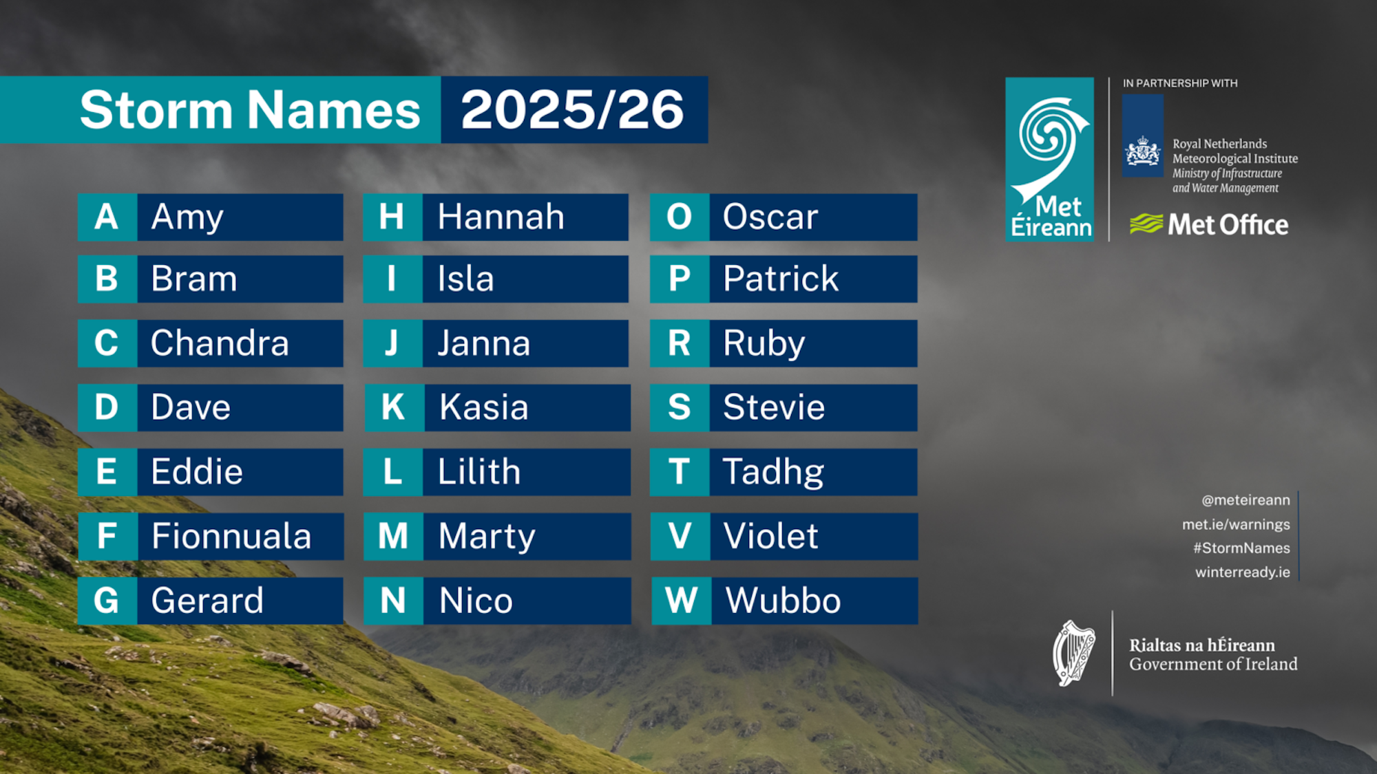
Met Éireann collaborates with the UK Met Office and Dutch meteorological service KNMI to name significant storms, beginning when Orange wind warnings are issued over land areas. The 2025/26 storm season features names including Amy, Bram, Chandra, and notably for Cork residents, Patrick among the selected names.
This naming system proves highly effective in raising public awareness, with surveys showing 93% of people in amber warning areas were aware of Storm Floris alerts, and 83% took preparatory action. During Storm Éowyn in January 2025, Met Éireann's website received over 3 million visits in just two days, demonstrating the public's appetite for timely weather information.
National Emergency Response
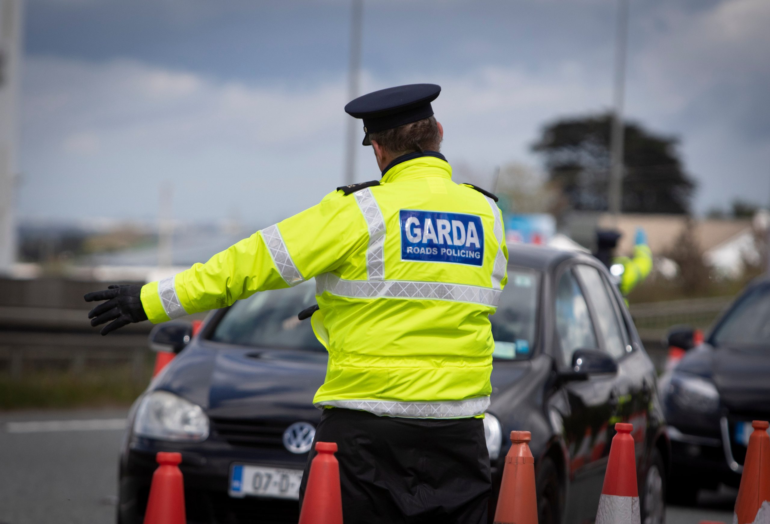
When severe weather threatens, the National Emergency Coordination Group convenes under the Department of Housing, Local Government and Heritage. This brings together all government departments, local authorities, An Garda Síochána, the Defence Forces, HSE, Coast Guard and other relevant agencies to ensure a coordinated 'whole-of-government' response. Met Éireann provides crucial weather briefings to support locally led responses throughout any emergency.
Your Response Strategy
The warning system's effectiveness depends entirely on public response. For Yellow warnings, stay alert, monitor updates, and avoid unnecessary risks. Orange warnings demand active preparation, property protection, and acceptance that significant disruption is likely. Red warnings require immediate action: stay indoors, follow official guidance, and travel only if absolutely essential for safety.
Cork residents have become particularly adept at interpreting these warnings, having experienced their fair share of Atlantic storms rolling in across the harbour. Services like Cork Safety Alerts complement Met Éireann's national warnings with hyperlocal updates that help communities respond to rapidly changing conditions on the ground.
The warning system represents more than meteorological science; it embodies Ireland's commitment to collective safety. Whether you're planning a weekend trip to West Cork or simply commuting through the city, understanding these warnings could prove essential for your safety and peace of mind.