Ex-Hurricane Humberto: Tracking Towards Ireland - Will It Impact Us?
Exact track at this time remains uncertain.
Ireland may face a significant storm system on Friday as the remnants of Hurricane Humberto track across the Atlantic, with amateur weather forecasters warning of potentially destructive winds and heavy rainfall. However, considerable uncertainty remains about the exact path and intensity of the system.
Hurricane Humberto, currently a Category 4 hurricane in the Atlantic, is expected to transition into an extra-tropical depression as it moves over cooler waters towards north-west Europe later this week. The system could re-intensify when it interacts with the jet stream, potentially bringing severe impacts to Ireland by Friday, 3 October, into Saturday morning.
Nick Critch, Weather Alerts Ireland, said:
"Hurricane Humberto (ex hurricane by the time it gets to Europe) could be a very big storm for Ireland! Still lots of uncertainty on the path but the risk of it impacting Ireland with destructive winds! This is definitely one to watch!"
The forecaster later clarified that whilst Humberto is currently a Category 4 hurricane, it will not arrive as a hurricane due to the cold waters of the north Atlantic. The key concern is how the ex-hurricane develops as it moves along the Atlantic with the jet stream.
Cathal Nolan, Ireland's Weather Channel, warned:
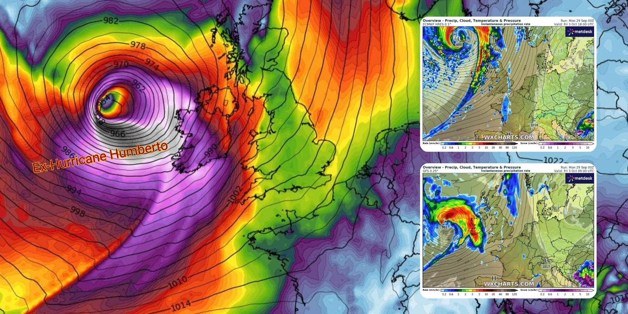
"There's a wide spread of solutions across the various weather models this morning. The GFS shows a severe storm striking the west and north of the country on Friday, while the Met Office model shows a deepening but not yet severe storm impacting a wider portion of the country, while the ECMWF keeps the storm offshore to out northwest."
Alan O'Reilly, Carlow Weather, added:
"Friday needs careful watching now as remnants of Humberto could re-intensify when it interacts with the jet stream. Still uncertainty on the track so keep up to date and hopefully the worst of it stays away from Ireland."
Weather model guidance suggests that if the system takes a more southerly track, Ireland could experience winds gusting to 110-130 km/h in exposed areas, particularly along Atlantic coasts and later on the Irish Sea coast. Rainfall totals of 30-50 mm are possible widely, with 60-90 mm on south-west mountain slopes, raising concerns about river and flash flooding.
For Cork, the potential impacts would be most severe if the storm tracks close to or over the county on Friday afternoon and evening. The greatest risks would include coastal flooding along the south coast, surface flooding in urban areas, and travel disruptions on routes such as the N40 and M8.
Met Éireann's current forecast for Friday remains relatively benign, describing "another wet and breezy day" with "widespread rain, heavy at times" and temperatures of 16 to 18 degrees with fresh to strong southerly winds. The national forecaster has not yet issued any warnings for the day.
The divergence between amateur forecasters' warnings and Met Éireann's current forecast reflects the significant uncertainty in the storm's development and track. Weather models are showing different solutions, and the situation will become clearer as the system approaches.
Please continue to monitor official forecasts from Met Éireann over the coming days and be prepared to adjust plans if warnings are issued. With soils already saturated from recent rainfall, any additional heavy rain could lead to localised flooding, particularly in areas prone to surface water accumulation.